If you have ever looked at a parcel in Pelham and thought, “There’s plenty of land here, so building should be simple,” you are not alone. Raw land can look full of promise, but in Pelham, build potential often comes down to details you cannot confirm from a listing photo or a quick map check. If you are considering land, a tear-down, or a larger parcel with future upside, this guide will help you understand what really matters before you commit. Let’s dive in.
Why buildability in Pelham is not simple
In Pelham, a parcel is not truly “buildable” just because it is large or appears to sit in a residential zone. The town’s zoning, subdivision, health, wetlands, access, and utility rules can all affect whether you can place a home where you want, or at all.
That matters because Pelham remains heavily dependent on private infrastructure. According to the town’s Water Commission, about 95% of residents use private wells and 100% use private septic systems, with public water available only in limited areas that need to be verified by address.
This is one reason a land search in Pelham needs more than a basic online review. The Planning Department is a key first stop, but final feasibility may also involve the Health Agent, Highway Department, Conservation review, and in some cases the Zoning Board of Adjustment.
Start with zoning, but do not stop there
Pelham’s zoning ordinance was revised in March 2026 and includes residential, business, industrial, rural, and recreation-conservation-agricultural districts, along with overlay districts for aquifer, wetlands, floodplain, and mixed-use areas. For a buyer, the main takeaway is simple: zoning tells you part of the story, not the whole story.
A lot can be in a district that allows a home and still be a weak building candidate. Frontage, soils, slope, wetlands, access, and buildable area requirements often have just as much impact as the zoning label itself.
The town also notes that GIS-based maps are for general reference only. They should not be treated as final proof for surveying, boundaries, or permit decisions.
Pelham lot size and frontage basics
If you are evaluating a conventional lot for a single-family home, Pelham’s zoning table lists a minimum lot size of 43,560 square feet and 200 feet of frontage. For a two-family dwelling, the minimum lot size is 87,120 square feet with 200 feet of frontage.
Those numbers are important, but they are not the only test. Pelham also requires new single-family lots to contain 35,000 contiguous square feet of non-wetland area, while two-family lots need 55,000 contiguous square feet of non-wetland area.
That is where many buyers get surprised. A parcel may meet the gross acreage requirement on paper, but if wetlands split the lot or reduce the usable upland area, it may still fall short.
Road frontage matters more than many buyers expect
For one- and two-family lots approved after the 2007 amendment, Pelham requires 200 continuous feet of frontage on a state-maintained highway, a town Class V or higher street, or an approved new street that remains directly accessible to emergency and school vehicles.
In practical terms, this means a lot with plenty of acreage can still fail the buildable test if access is not compliant. When reviewing raw land in Pelham, frontage is one of the fastest filters to apply.
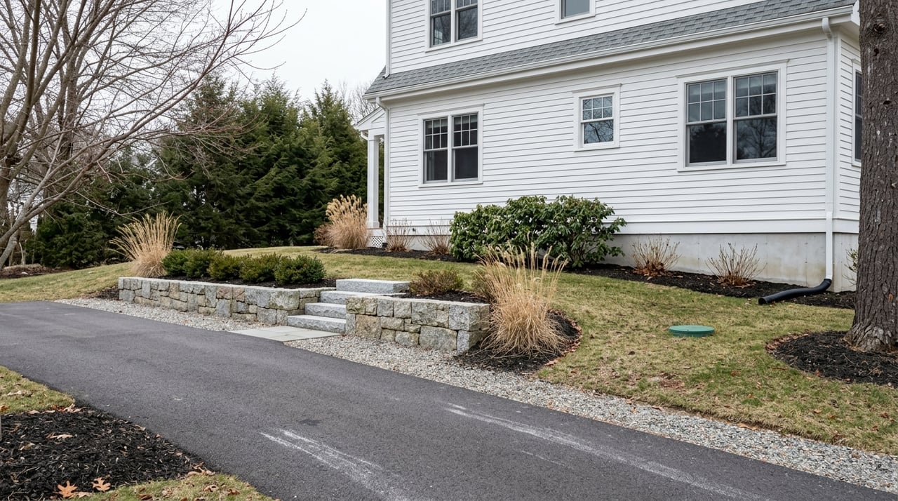
Site conditions can make or break a lot
Some of the biggest land mistakes happen when buyers focus on acreage and overlook physical constraints. Pelham’s local rules exclude several types of land from buildable-area calculations used for new lots and subdivisions.
These excluded areas include:
- Wetlands
- Land with slopes over 25%
- Flood-prone land
- Land inside certain easements
- Ledge or bedrock areas with less than four feet of naturally occurring non-wetland soil cover
This is why a parcel can look spacious and still offer limited real building opportunity. If a lot has steep grades, extensive rock, or wet ground, your usable area may shrink quickly.
Building envelope standards are specific
Pelham’s subdivision regulations require a proposed building envelope of at least 15,000 square feet and at least 75 feet wide. That envelope must be outside setbacks and Wetlands Conservation District boundaries, and at least half of it must be on land sloping 15% or less.
For buyers, this is a very practical standard. It means the lot needs more than enough room for a house in theory. It needs a workable area where a house can actually be placed under the town’s rules.
Wetlands are a major Pelham factor
Wetlands should never be treated as a minor site detail in Pelham. The town’s Wetlands Conservation District creates a 50-foot buffer around ponds, brooks, seasonal streams, and wetlands larger than 2,000 square feet.
The town also notes that wetlands are defined by soil type, not just visible standing water. So a wooded lot that looks dry at first glance may still include regulated wetland areas.
No structure may be placed within the Wetlands Conservation District, and impacts are also regulated by the New Hampshire Department of Environmental Services. If a parcel has wet spots, marshy edges, or seasonal drainage features, that should trigger a feasibility review early.
Wells and septic shape the real answer
Because most of Pelham relies on private wells and private septic, utility feasibility is central to build potential. In many cases, the lot must support both a home site and a septic area while still meeting setback and buildable-area requirements.
Pelham’s well ordinance requires a well permit before installation. For new construction, separate wells are generally required unless an exception applies.
The ordinance also requires:
- A minimum 75-foot setback from septic and lot lines
- A pump test showing at least 4 gallons per minute sustained over four hours before building permit issuance
On the septic side, Health Agent approval is required before a system can be built. Septic plans must be prepared by a New Hampshire-licensed subsurface disposal system designer.
This is one reason soil and ledge testing matter so much. A lot needs enough suitable area not only for the house, but also for septic design and required separation distances.
Access and permits affect the timeline
Even if a parcel checks the zoning and site-condition boxes, permitting still matters. Pelham’s building permit packet requires a plot plan, zoning and setback confirmation, and a New Hampshire DES-approved septic plan when bedroom count is increasing.
The occupancy process includes final building, electrical, plumbing, and driveway inspections, plus septic as-builts or approval, a well test, and other closeout items. In other words, a parcel’s path from raw land to finished home involves several coordinated steps.
Driveway approval is also separate. The process involves the Planning Department and Highway Department, and final driveway inspection is required before occupancy.
State and town road access can differ
For town roads, the Highway Department handles access issues. Several roads in Pelham are state-maintained, including Route 38, Mammoth Road, Windham Road, Sherburne Road, Old Gage Hill Road, Main Street, and Keyes Hill Road.
That distinction matters because access review may depend on which road serves the parcel. It is another reason early confirmation is worth your time.
Larger parcels may offer upside and added complexity
If you are looking at acreage with possible subdivision potential, Pelham does provide a Residential Open Space Subdivision path by special permit. This option starts with a conventional yield plan and requires Planning Board and Conservation Commission review.
The ordinance sets a minimum development parcel size of 15 acres. It also generally requires at least 40% of the parcel to remain open space, with at least 50% of that open space in uplands.
The minimum building lot size in that format is generally 30,000 square feet, but the Planning Board can require larger lots if soils, water table, or ledge conditions warrant it. For development-minded buyers, that means upside is possible, but it comes with more review layers and site analysis.
Tear-downs can sometimes be more straightforward
In some cases, a tear-down or older home site may be easier to evaluate than untouched raw land. Existing lawful access and a history of utility use can remove some uncertainty, though they do not eliminate the need for due diligence.
That said, every parcel still needs a current review. Existing conditions, septic capacity, setbacks, and updated local requirements all matter.
A smart due diligence checklist for Pelham land
Before you move forward on a lot in Pelham, focus on confirming the basics in the right order. A careful review early can save you time, money, and frustration later.
A practical checklist includes:
- Confirm the current zoning map and tax map
- Order a survey or plot plan
- Identify wetlands and any floodplain involvement
- Test soils and evaluate ledge conditions
- Verify compliant road frontage and driveway access
- Ask the Planning Department and Health Officer whether the lot can support your intended use
- Confirm whether public water is available by address, rather than assuming it is nearby
- Review whether the parcel may trigger added review for wetlands, floodplain, or pipeline proximity
Pelham’s planning materials make the broader point clear: local review is meant to happen before a purchase closes, not after.
Why expert guidance matters with land
Land is one of the easiest property types to misread because so much of the risk sits below the surface or inside the ordinance. A parcel that looks like a bargain can become expensive quickly if frontage, wetlands, soils, or septic layout do not cooperate.
That is where a detail-focused approach matters. When you work with someone who understands how site conditions, local regulations, and development potential fit together, you can ask better questions and make stronger decisions.
If you are evaluating land, a tear-down, or a development-minded purchase in Pelham, the goal is not just to find acreage. It is to understand what the parcel can realistically support and what steps it will take to get there.
If you want a clear, informed read on a Pelham land opportunity, connect with Rebecca Curran for thoughtful guidance grounded in local market knowledge and technical property insight.
FAQs
What makes land buildable in Pelham, NH?
- Buildability in Pelham depends on more than zoning. You also need to consider frontage, non-wetland area, slopes, wetlands, septic feasibility, well requirements, and legal access.
How much frontage does a Pelham, NH lot need for a house?
- For one- and two-family lots approved after the 2007 amendment, Pelham generally requires 200 continuous feet of frontage on a qualifying road or approved new street.
Do most homes in Pelham, NH use public water and sewer?
- No. According to the town, about 95% of residents use private wells and 100% use private septic systems, with public water available only in limited areas.
How do wetlands affect building potential in Pelham, NH?
- Wetlands can reduce usable land area, trigger setback and buffer restrictions, and limit where structures can be placed. Pelham’s Wetlands Conservation District includes a 50-foot buffer around certain wetland features.
What should you check before buying raw land in Pelham, NH?
- Start by confirming zoning, tax map information, frontage, wetlands, floodplain, soils, ledge conditions, driveway access, and whether the lot can support the use you intend through Planning and Health review.